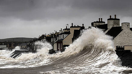
Met Éireann Issues Highest 'Red Warning' For These Counties As Storm Ophelia Approaches

If you have any hatches, then please, proceed to batten them down as it's about to get positively blustery outside.
Storm Ophelia is on the horizon and she is promising all sorts of ruckus when she eventually reaches these shores. Met Éireann had already issued a status yellow warning for the majority of the country - which essentially translates to, 'watch yourselves now'.
It has now become apparent however that the eye of Ophelia (easily, in my opinion the third worst 'eye' after 'Eye Of The Tiger' and 'iPod Shuffles') will pass directly over parts of Western Ireland. The result will be winds with gust speeds in excess of 130km/h which, to put that in perspective, is faster than a cheetah but far slower than a Nissan Micra's top speed. As such, the weather warning has been upgraded to 'Red' for counties Kerry, Cork, Clare, Galway, Mayo. The red warning advocates that people "take action to protect themselves and their property", in other words, they're expecting this to go full 'Mad Max' in the immediate aftermath around these parts. My advice is to keep yourselves indoors and to choose a tattered leather outfit that suits you asap.
The warning comes into effect on Monday at 9am and carries on until 3am on Tuesday.
They have yet to announce what the expected rainfall from the storm will be and have declared that by the time it reaches Ireland it will have been downgraded from a 'hurricane' to a 'post-tropical storm'. The yellow warning still applies to the rest of the country with winds expected to be gusting around 110-130km/h.
In essence, Ophelia don't seem like she should be messed with so keep yourselves safe.